

Severe Red Flag Warning Issued for Eastern Antelope Valley
- PRESS RELEASE

- Aug 21, 2025
- 2 min read
Updated: Aug 25, 2025
EASTERN ANTELOPE VALLEY
Severe Red Flag Warning
Wed, Aug 20, 2025, 9:00 AM PDT
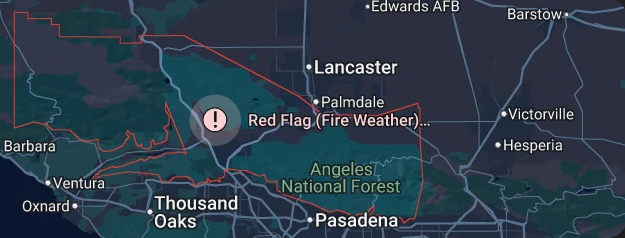
RED FLAG WARNING REMAINS IN EFFECT FROM 9 AM PDT WEDNESDAY TO 9 PM PDT SATURDAY FOR AN UNSEASONABLY HOT AND UNSTABLE AIR MASS CAPABLE OF PRODUCING EXTREME FIRE BEHAVIOR FROM VERTICAL PLUME GROWTH. LOW RELATIVE HUMIDITY AND LOCALLY BREEZY WINDS FOR PORTIONS OF THE MOUNTAINS AND FOOTHILLS OF LOS ANGELES AND VENTURA COUNTIES.
TEMPERATURES
Unseasonably hot high temperatures, generally 95- 110 degrees and highest Thursday through Saturday, producing unseasonably unstable conditions.
RELATIVE HUMIDITY
Minimum relative humidity 8-20 percent, lowest Wednesday and Thursday.
THUNDERSTORMS
Isolated thunderstorms will be possible Friday through the weekend, and any accompanying lightning strikes will be capable of starting new fires on the peripheries of rain cores.
WINDS
Southwest at 10-20 mph gusting to 20-25 mph over the western Antelope Valley Foothills and vicinity and in other wind- favored areas such as through passes and canyons. Lighter winds elsewhere. Passing outflow boundaries could bring sudden wind- shifts and increased fire-spread rates, even from distant thunderstorms.
IMPACTS
If fire ignition occurs, conditions are favorable for extreme fire behavior and rapid fire growth, which could threaten life and property. Be aware of sudden re-direction of fires in response to passing outflow boundaries.
ADDITIONAL DETAILS
Fire-weather headlines may eventually need to be extended into Sunday.
PRECAUTIONARY/PREPAREDNESS ACTIONS
A Red Flag Warning means that fire-weather conditions are expected to be favorable for the development of extreme fire behavior. Use extreme caution with anything that can spark a wildfire. Residents near wildland interfaces should be prepared to evacuate if a wildfire breaks out.
See readyforwildfire.org and wildfirerisk.org for information.
Comments